
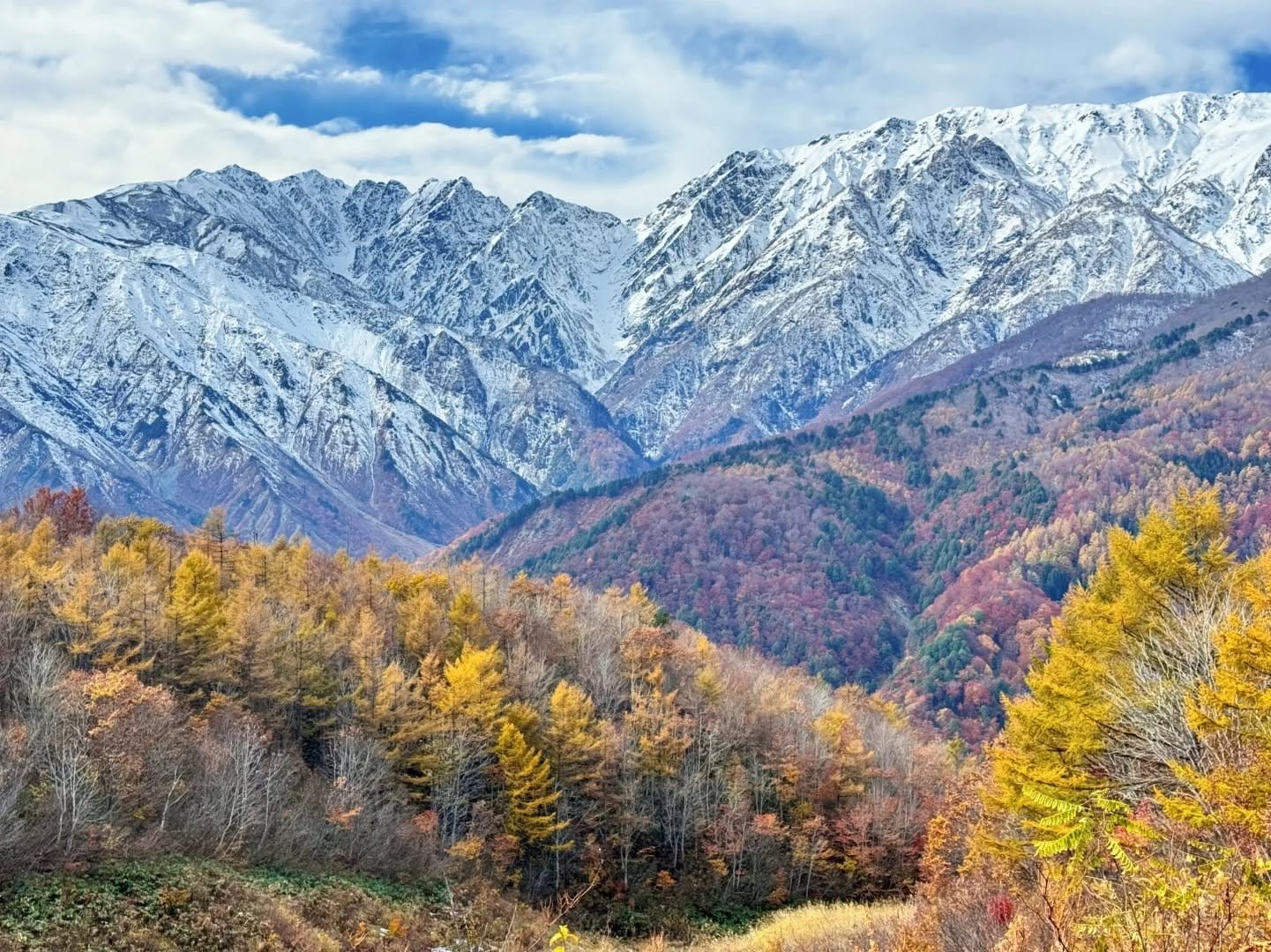
Nagano's Autumn Colour Ladder: A Week-by-Week Calendar by Altitude
From 2,500m in late September down to the 600m castle towns in mid-November, here is how Nagano's foliage season actually works — and how to read the koyo bulletins in the last week before you travel.
Aug 14, 2026·✍️ olablog·⏱ 12 min read
From 2,500m in late September down to the 600m castle towns in mid-November, here is how Nagano's foliage season actually works — and how to read the koyo bulletins in the last week before you travel.
Tap a region to browse articles
The question I get every autumn has the same shape: "Will there be colour in Nagano in late October?" The honest answer disappoints people slightly — it depends entirely on how many metres above sea level you plan to be standing.
Nagano is the most mountainous prefecture in Japan. Within one prefecture you can stand in the Senjojiki Cirque at over 2,600 metres, or wander the wooden post town of Narai at around 900. That two-thousand-metre spread, converted into time, is roughly seven to eight weeks. Autumn here isn't a golden week; it's a front that drains downhill for nearly two months. Understand that and you almost never miss. Miss it and you make the classic mistake: picking a place first and a date second, instead of picking the week you can actually get off work and then finding which altitude band is peaking then.
What follows is that ladder as a calendar. It isn't tied to any particular season — the only thing to redo annually is a correction explained near the end.
Why the ladder works
Air temperature drops fairly predictably with elevation, around 0.5 to 0.6°C per 100 metres. Trivial until it compounds: between Matsumoto (about 600m) and Tatamidaira on Mt. Norikura (about 2,700m), the same morning is more than ten degrees colder up top.
Leaves start to turn when the daily minimum drops to around 10°C or below, and turn vividly when it goes lower still, especially with sunny days and a wide day-night swing. Combine the two and you get a rule of thumb that holds up well: the colour front descends roughly 250 to 300 metres a week. Kamikochi at 1,500m and Nagano city at 370m are over a thousand metres apart — about four weeks — which is why Zenkoji is still green when Kappa Bridge peaks.
Falling temperature is the necessary condition, but the switch is usually flipped by the first frost (初霜). One unusually cold night can push a mountainside from "slightly yellowing" to spectacular in days, while a warm autumn where nights never get cold enough gives washed-out, patchy colour. You aren't tracking dates; you're tracking temperature.
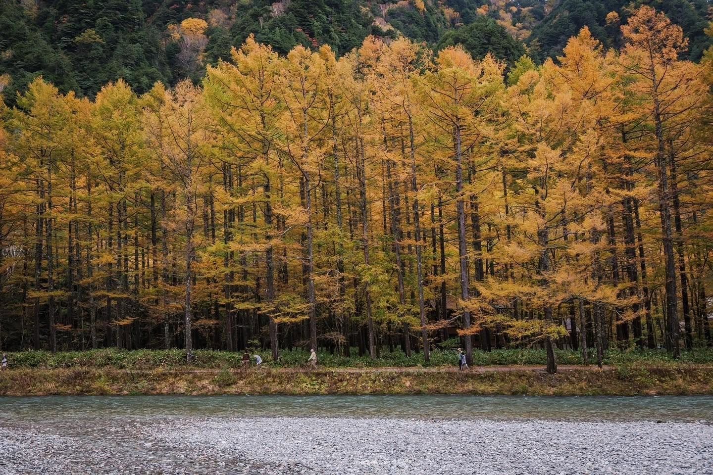
Three tree groups give each band its signature: nanakamado and alpine shrubs, burning red above 2,000m and turning first; momiji and mountain maples through the 1,000–2,000m band; and karamatsu (larch), metallic gold, everywhere, closing the season a week or two after the maples drop.
The calendar, band by band
Treat this as a starting frame, not a fixed schedule.
Late September: above 2,500m
Nagano's autumn starts earlier than most visitors expect. While Tokyo is still humid, there is frost above 2,500 metres.
Senjojiki Cirque in the Central Alps, by ropeway from Komagane, is the easiest of the group — valley floor to over 2,600m in about half an hour, no hiking. In the last ten days or so of September the glacial bowl typically wears red and orange alpine shrub against grey rock. Norikura Tatamidaira at around 2,700m is the highest point in Japan reachable by public bus; cars are banned, and the ride up is half the experience as colour shifts with each switchback. The Tateyama–Kurobe Alpine Route, from the Nagano side via Ogizawa, also peaks now around Murodo — famous enough that late-September weekends mean long queues at the transfer stations.
The thing to know here: the weather is no longer autumn, it's early winter. First snow in the last week of September is entirely possible, and mountain transport suspends on short notice. Keep a low-altitude fallback in your pocket.
First half of October: 1,500–2,000m
The busiest, most photographed band, and the one most readers will actually visit.
Kamikochi at 1,500m warms through early October, but the floor around Kappa Bridge waits for the second half of the month. What's best now is higher up — Dakesawa, or the trail towards Karasawa — where you see the colour front with your own eyes: red above, half-turned in the middle, green below. The valley floor by floor is in the week-by-week Kamikochi calendar.
Happo-one and Happo Pond in Hakuba, at 1,800–2,060m, usually come good between late September and mid-October, producing the region's signature image: a glassy pond mirroring the Shirouma range under its first dusting of snow. The best part sits behind about an hour of rocky trail from the top lift station.
Shiga Kogen, across 1,500–2,000m with dozens of small lakes in forest, is my pick for people who don't want to hike — drive the plateau road and stop at whichever pond looks good. Tsugaike Nature Park at about 1,900m is an alpine marsh with a flat boardwalk loop, bronze grass ringed by red forest, easy enough for older travellers.
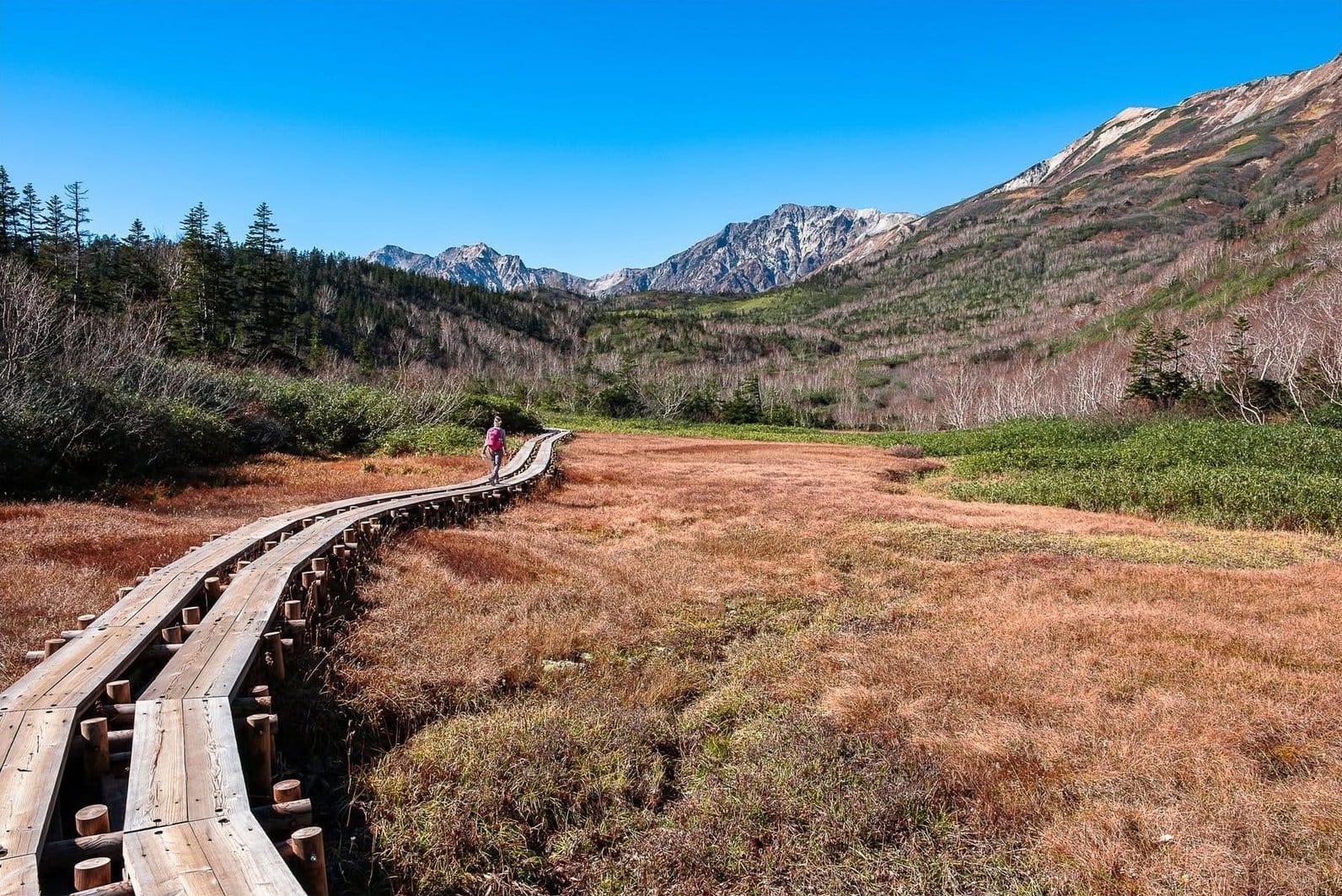
Coming from Tokyo and want this band in a short trip? The two-day Kamikochi–Hakuba autumn trip touches both ends of the prefecture without you wrestling with mountain bus timetables.
Mid to late October: 1,000–1,500m
The sweet spot. Cold enough for good colour, not cold enough to be miserable, and far better served by infrastructure than the high country.
The Hakuba valley floor at 700–1,000m and lower slopes like Iwatake light up here. Larch turns metallic gold, and with luck you catch the three-layer scene: snow on the Alps, red mid-slope, gold underfoot. Detail for this valley is in the Hakuba foliage forecast.
The Karuizawa highlands at about 1,000m are a different proposition: villa forest, cycle paths, wooden chapels, tree-tunnel roads, with Kumoba Pond at its best now. It's also the easiest destination in the prefecture — just over an hour from Tokyo by shinkansen — so if you have one free day and don't want to gamble on alpine weather, the Karuizawa day trip is the safe play.
The Venus Line and Tateshina–Kirigamine, along 1,400–1,900m, is the finest mountain road in Nagano, and unusual in that it isn't about maples at all but grassland turning tawny gold across bare rolling hills, with Mt. Fuji to the south on a clear day. Grass turns slightly earlier than leaves, so early October already works; mid-month balances gold grass against red forest lower down. Full write-up at Venus Line. The upper Kiso valley around Kiso-Fukushima and Torii Pass, 900–1,300m, arrives late October — dense forest, few international visitors, intact stretches of the old Nakasendo.
Late October to mid-November: 600–1,000m
The band of towns and cities, and the one most people skip because they assume the season is over.
Matsumoto at about 600m: the trees around the castle moat turn from early to mid-November, and the black keep reflected in water against yellow and red is one of the best compositions in Japan this time of year — weather-independent in a way the mountains never are. Nagano city and Zenkoji at around 370m is the bottom rung, best around mid-November and better still on a damp, quiet day. Obuse has the Ganshoin garden with its big maple, plus new-chestnut season lining up neatly. Narai-juku and Tsumago-juku on the Nakasendo, at roughly 900m and 400m, are intact Edo post towns, and Narai turns about a week and a half ahead of Tsumago. Walking that wooden street early, before the tour buses, with a red-gold ridge behind it, is the Nagano autumn image I remember longest.
Late November: what's left
Most of the prefecture is bare, but two things survive: larch, holding golden-brown in the lower valleys, superb in low late-autumn light, and the far south around Iida and the lower Kiso, the mildest corner of Nagano, where some temple gardens and gorges keep colour into early December. Otherwise this is when onsen take over — Yudanaka, Shibu, Nozawa. The reason to be here shifts from looking to soaking, which isn't a bad trade.
How much a year can slip
Short answer: about a week either way. If the frame says "mid-October", a given season might mean the 8th or the 22nd — wide enough to ruin a trip locked in months ahead. The driver is September temperature: a long summer with nights that never drop below 15°C means late, weaker colour, while a distinct early cold snap in mid-September pulls the ladder forward a week and deepens everything.
Worth saying plainly, the trend in recent seasons has been later than the old numbers suggest. Much of what's online is date data copied forward for years without anyone re-checking, so treat any article declaring one confident peak date with suspicion. There's also a risk unrelated to temperature — late-season windstorms, where a single gusty night strips a band at its peak. The only defence is slack in the plan.
The last week before you travel
The frame narrows things from a distance; to lock a date you need current-season data. Do this seven to ten days out; it takes fifteen minutes.
Four Japanese labels cover almost every source: 色づき始め (starting to turn, roughly a week to ten days from good), 見頃 (peak — the word you're hunting), 見頃過ぎ (past peak), 落葉 (leaves down). Two more you'll see: 紅葉前線, the foliage front, and 冠雪, snow-capped peaks. When 冠雪 is reported in the Northern Alps while the valleys are still green, the three-layer scene is forming.
Sources, in order of trust:
- Live cams and dated photo updates from the ropeways, huts and resorts themselves — Happo-one, Tsugaike, Shiga Kogen, Senjojiki, the lodges inside Kamikochi. Real data shot on site, often near-daily in season.
- Official prefectural and municipal tourism pages. Slower, but broad, and where closures and suspended mountain routes get announced.
- Commercial koyo forecasts. Useful from a distance, but coarse — one entry for all of "Hakuba", with no separation by band.
- Social media photos with a clear date. Undated photos are the single biggest cause of misplanned trips.
Then correct the ladder. Find one anchor high up — a Senjojiki cam or hut diary reporting 見頃 on a specific day — and compare it against the frame above. Four days early means the whole ladder is running four days early this season. Apply that offset to your band, then book into the middle of the predicted window, never the leading or trailing edge. A side trick I've found surprisingly effective: instead of foliage forecasts, read the ten-day minimum-temperature forecast for Matsumoto and subtract for altitude. Several consecutive nights below 10°C, dry and calm, is a reliable recipe for a good week in the corresponding band.
The classic mistake
You see a photo of Kappa Bridge on fire, decide you must go to Kamikochi, and book for the first week of October because that's the week you could take off. You arrive to a lush green valley. You did nothing wrong — you built the trip around a place instead of an altitude.
Do it the other way and you almost never lose. Work out which week you're free, check which band is at 見頃 then, and pick a destination inside it. First week of October and you want intensity? Skip Kappa Bridge — go to Tsugaike, Shiga Kogen, or up Happo-one. Second week of November and you still want leaves? Stop climbing — Matsumoto, Narai, Zenkoji.
Nagano is generous in exactly this way: at any point from late September to mid-November, some altitude band in the prefecture is peaking. And if your trip runs two days or more, deliberately spread it across two bands a few hundred metres apart. If the high band is past, the low one saves you; if the low band isn't ready, the high one still delivers.
For the wider picture — transport, food, where to sleep — there's a separate overview at the Nagano autumn guide.
FAQ
If I only get one week all autumn, which week? For the best odds without hiking, mid to late October. Your window is widest then: the 1,000–1,500m band is peaking, the band above still has colour in places, and the low band has started. Whether the ladder runs early or late that season, you'll have something.
Is anything left in late November? Yes, but go low and adjust expectations: golden larch in the lower valleys, the far south around Iida, temple gardens in the cities. I'd shift the trip's centre of gravity to onsen and post towns rather than chase leaves.
Is colour always better higher up? No. High up it arrives earlier and looks intense because the day-night swing is wide, but the vegetation is low shrub and alpine grass, not maple forest. The deep momiji red most people picture lives in the middle and lower bands. High country gives grandeur; low country gives saturation.
What can I reach without a car? Quite a lot — Kamikochi, Happo-one, Tsugaike, Senjojiki, Karuizawa, Matsumoto, Nagano, Obuse, Narai and Tsumago all work by train and bus. The hard ones are the Venus Line and Shiga Kogen; seasonal buses exist but run infrequently, and the point of both is stopping wherever you feel like it.
How far ahead should I book? Lodging in Kamikochi, Karuizawa and Hakuba on peak mid-October weekends fills very early, so book the hard parts well ahead. Keep the soft parts flexible — which band, which day you go up — and settle them in the final week once you have current photos. Weekdays also matter more than people expect: the bottleneck isn't the viewpoint but transport, and a Tuesday can mean a third of the waiting.
Should I cancel if it rains? Not for light rain — wet leaves read deeper, and mist between ridges is atmospheric. Avoid strong wind: a gusty night can strip the peaking band, and wind is the commonest reason lifts stop. On a windy day drop to lower ground; Matsumoto, Obuse and Narai don't depend on a cable at all.
So don't ask when Nagano is at its best. Ask which altitude band is peaking during the week you're free, and go stand there. The second question always has an answer. The first one never does.
More from this region — Chubu (Nagano, Kanazawa)
View all →
One Day in Nagano in Autumn: Three Itineraries, and Why You Have to Pick One
12 min · tips
Two Days and One Night in Nagano in Autumn: The Alps Loop or the Northern Loop
15 min · tips
Nagano in Autumn: Beating the Crowds and Controlling the Cost
11 min · tips
Autumn in Nagano: the foliage here is an altitude ladder, not a date
11 min · tips