
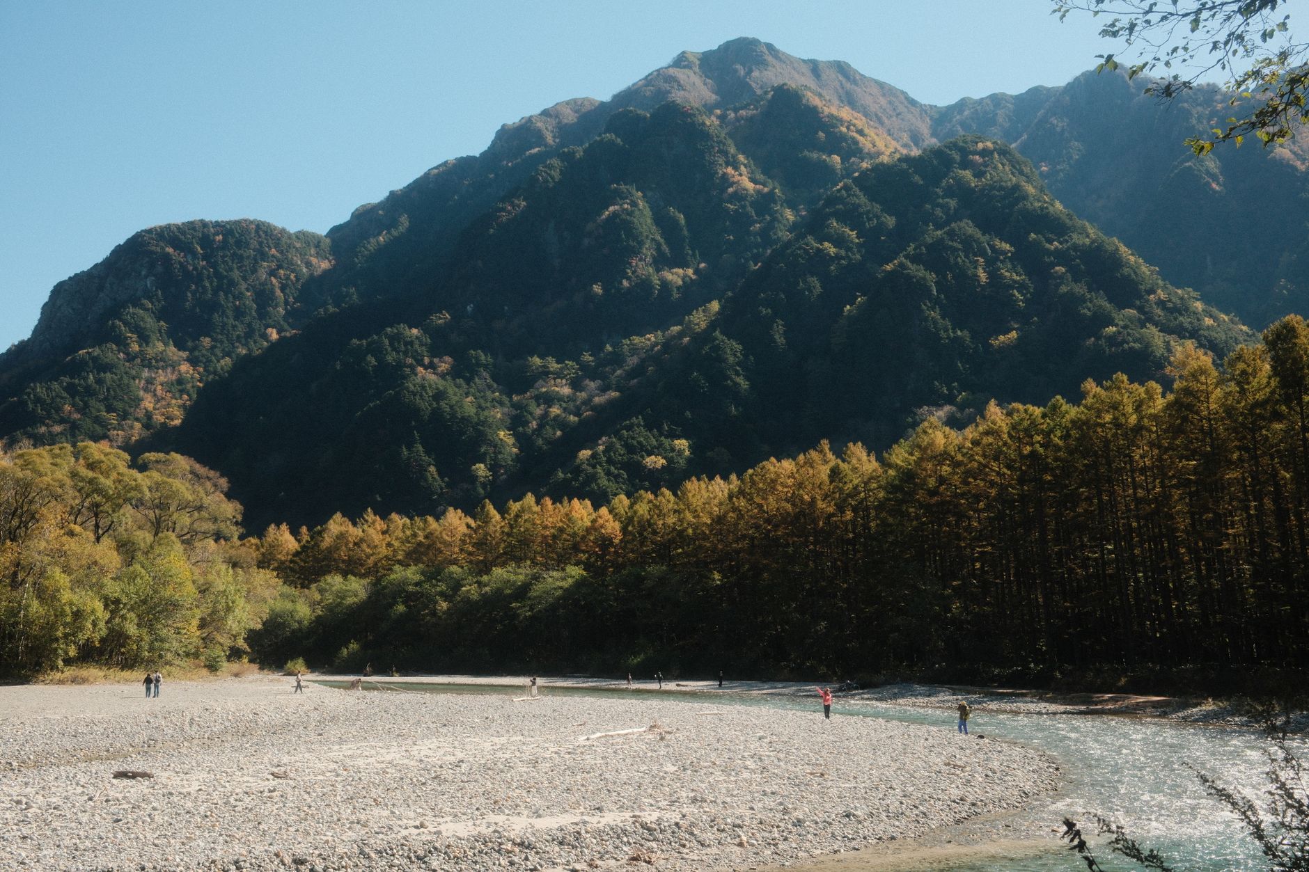
Kamikochi in Fall Foliage: Tracking the Golden Wave by Elevation
From Karasawa in late September down to Taisho Pond in late October, here’s how to read koyo forecasts, compare recent years, and choose the mountain day least likely to disappoint.
Aug 12, 2026·✍️ olablog·⏱ 17 min read
From Karasawa in late September down to Taisho Pond in late October, here’s how to read koyo forecasts, compare recent years, and choose the mountain day least likely to disappoint.
Tap a region to browse articles
There’s a very particular kind of disappointment that Japanese foliage-watchers know all too well: you take time off work more than a month in advance, book the bus, get up at four in the morning, travel for three hours, and then stand at Kappa Bridge looking up at both mountainsides only to see… a healthy, spotless sea of green, with nothing wrong except that it isn’t what you came to see. Or the opposite happens: you arrive exactly one week too late, most of the valley has already shed its leaves, bare branches stand against a gray sky, and you tell yourself, “I’ll go earlier next year”—only to miss in the other direction the following year.
The problem is that most of us think of fall foliage as an event: “Kamikochi’s autumn is in October.” But here, the changing leaves aren’t a single event. They’re a wave that flows from high to low over roughly five to six weeks. The elevation difference between the Karasawa Cirque and the surface of Taisho Pond is about 800 meters, and those 800 meters translate into nearly a month of time. Once you understand this, it’s almost impossible to get the timing wrong: you’re not tracking “Kamikochi’s autumn”; you’re tracking a specific elevation band during a specific week.
This article is for people living in Japan or flying in for a visit who have only one or two days to spare. I’ll walk through the schedule by week and elevation, then show you how to read koyo forecasts in Japanese so you don’t have to rely on anyone else’s article—even this one—and finally explain how to build your own comparison table for recent years so your intuition becomes increasingly accurate.
Why Kamikochi has three “foliage seasons,” not one
An 800-meter difference means a three-week difference
The floor of the Kamikochi Valley sits at around 1,500 meters—already higher than most foliage-viewing spots in Japan. But the rocky rim around the Karasawa Cirque is around 2,300 meters, while the Dakesawa area lies in the middle, at roughly 2,000–2,300 meters. The familiar rule among Japanese mountaineers is that the foliage front descends by several dozen meters each day, or several hundred meters each week. Apply that figure here and you’ll see why Karasawa is at its best while Kappa Bridge is still lush and green, and why the valley floor is bursting with color by the time the upper elevations are already covered in snow.
That’s also why questions like “Will Kamikochi still have leaves at the end of October?” always have two equally correct answers: it will still be beautiful if you go around Taisho Pond, but it may already be completely over if you’re planning to climb to Karasawa.
Three groups of trees, three colors, three timings
Elevation isn’t the only factor; the type of tree also determines the timing. In Kamikochi, there are three groups you should be able to distinguish:
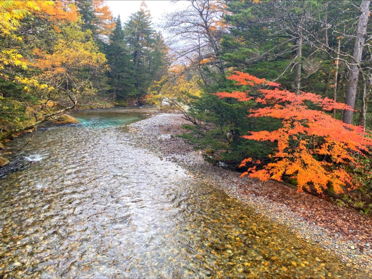
- Nanakamado (Japanese rowan): vivid red, growing abundantly at higher elevations around Karasawa and along rocky slopes. This is what creates the intensely red cirque photos you often see online, and it’s also the group that changes color earliest.
- Dakekanba and other mountain birches: lemon yellow, with white trunks, growing in the middle elevations. They create the golden bands stretching across the Dakesawa slopes in early October.
- Karamatsu (larch): golden brown with a metallic sheen, growing thickly on the valley floor. This is the group that brings the season to a close, usually changing color last and giving Kamikochi a “second autumn” after the maples have mostly shed their leaves.
Once you know these three groups, you’ll read online photos much more accurately: just look at the dominant color and you can guess which elevation they were taken at and how long ago they were shot.
The foliage schedule by week and elevation
Here’s the framework I use when planning. Treat it as a starting point, not a fixed calendar—the next section explains how to shift it forward or backward by a few days depending on that year’s weather.
Week 3 and week 4 of September: Karasawa speaks first
The Karasawa Cirque, at around 2,300 meters, usually reaches its peak during the final ten days of September, though in some years it slips into the first few days of October. This is the most demanding destination in the article: from the Kamikochi Bus Terminal, the route goes through Myojin, Tokusawa, and Yokoo before following the river uphill to Karasawa. Strong hikers take around five to seven hours one way, with most of the route being a flat riverside trail that gradually becomes steeper toward the end.
A few practical things to know before you start dreaming: this is Karasawa’s busiest week of the year. The mountain huts in the area are almost fully booked, the campground is packed with tents, and reservations usually need to be made very early—booking policies vary from season to season, so check each mountain hut’s website directly. If you’re not used to sleeping in the mountains, consider Karasawa a goal for next year and focus on the two lower elevation bands instead.
A more manageable option for the same period is to walk to Tokusawa or Yokoo and return the same day. You won’t see the red cirque, but you will see the mountainside above changing color while the ground beneath your feet remains green—seeing the “foliage front” in person just once makes the concept immediately clear.
The last week of September into the first week of October: the Tokusawa and Yokoo transition zone
As Karasawa begins to lose its leaves, the 1,700–2,000-meter band along the Tokusawa–Yokoo trail takes over. This stretch is mentioned less often than the others, but it’s arguably the most pleasant: the trail is almost flat, the walking is relaxed, the mixed forest on both sides changes color in patches, and there are far fewer people than during the following two weeks. If you’re the kind of person who enjoys walking more than taking photos, this is your week.
Early to mid-October: Dakesawa
Dakesawa is the steep slope directly behind Kappa Bridge, rising toward the Hotaka Range. The climb from the bridge to Dakesawa Mountain Hut usually takes around three hours, with an elevation gain of roughly seven hundred meters. The trail is easy to follow, though some sections are rocky and there are a few shallow streams to cross. The great thing about Dakesawa is that you can make it up and down in a day without staying overnight, as long as you set out early.
The period from around October 1 to 15 is usually when Dakesawa looks its best: the yellow of the mountain birches mixes with the red of the rowans, with gray cliffs above and a dusting of fresh snow. Looking down, you’ll see that the valley floor is still only beginning to turn—and that’s your sign that Kappa Bridge still has about two weeks to go.
Safety note: from mid-October onward, the upper part of Dakesawa can freeze in the early morning. Good-grip shoes are essential, and if snow is in the forecast, don’t push your luck.
Mid to late October: peak season at Kappa Bridge and Taisho Pond
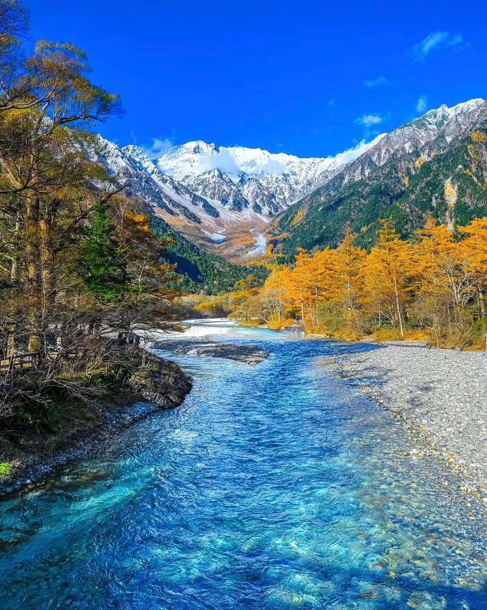
This is the golden week that most readers are actually looking for: from around mid-October through the final days of the month, the valley floor at 1,500 meters bursts into color. Kappa Bridge has the classic composition—a suspension bridge, the emerald-green Azusa River, and the Hotaka Range behind it—but if you only stand at the bridge, you’re seeing just one-third of the story.
Three places to combine in a single day:
- Taisho Pond: at its best early in the morning, when mist still hangs over the water and dead trees rise from its surface in reflection, with Mount Yakedake behind them. The trick is to get off at the Taisho Pond stop before the final terminal rather than riding all the way to the bus terminal and walking back.
- Tashiro Pond and Tashiro Marsh: located along the trail between Taisho Pond and Kappa Bridge, with golden pampas grass, fewer people, and beautiful morning light.
- Myojin Pond: about an hour on foot from Kappa Bridge, with water clear enough to see the bottom. There is an admission fee for the shrine grounds, so have some cash ready; check the official website for the fee and opening hours because they can change seasonally.
If I had only one day for the entire autumn, I’d choose a day during this period, walking from Taisho Pond up to Kappa Bridge, continuing to Myojin, and returning along the opposite bank.
Late October into early November: the second autumn
Once the maples have shed their leaves, the larch forest on the valley floor finally turns golden, covering the entire basin in a warm, unusual color that is completely different from the vivid reds people usually associate with fall. By this point, the cold is deep, with early mornings potentially dropping to around freezing, and the crowds have thinned considerably. In exchange, some services and lodgings begin closing one by one, and the entire Kamikochi area closes for winter around mid-November—the exact date varies each year, so you must check the official announcement before booking tickets.
Reading koyo forecasts yourself: what to look for and what to trust
Four Japanese keywords to memorize
Almost every Japanese foliage-information site uses these same four labels. Learn them and you can read the original sources instead of relying on reposted translations:
- 色づき始め — beginning to change color, usually with about one to one and a half weeks to go before the best viewing period.
- 見頃 — at its peak, the word you’re looking for.
- 見頃過ぎ — past its peak.
- 落葉 — leaves have fallen.
Another phrase you’ll often see is 紅葉前線 (the foliage front), along with 冠雪 (snow covering the peaks). When you see a report of 冠雪 on the Hotaka Range while the valley floor is still green, that’s the famous “three layers of color”: white snow on the peaks, red leaves in the middle, and green below.
The most reliable sources, in order
Here’s how I rank sources when deciding whether to go or postpone:
- Mountain hut diaries. Karasawa, Yokoo, Tokusawa, and the lodges in the valley often post dated photos almost every day during the season. This is real, on-site data, not a forecast model. The biggest advantage is the archive: you can look back at the same date last year or the year before.
- Kamikochi’s official website and live cameras. Updated photos and camera footage around Kappa Bridge immediately show you the current foliage conditions. This is also where trail closures, bridge repairs, and unusual bus services are announced.
- Foliage forecasts from weather companies. These predict the 見頃 week for popular destinations and are updated several times each season. They’re useful for planning from a distance, but their elevation resolution is very rough—there’s usually just one general marker for “Kamikochi,” without separating Karasawa from Taisho Pond.
- Social media photos. Use them only when the photo has a clear date and you can identify the location. Undated photos are the biggest source of bad planning.
A rule of thumb for working out the best week
Here’s what I do; it takes about fifteen minutes:
- Step 1: find a reliable reference point. For example, a mountain hut diary reports 見頃 on a specific date in Karasawa.
- Step 2: add about one week for every few hundred meters of descent. From 2,300 meters down to 2,000 meters, estimate roughly one week; from 2,000 down to 1,500 meters, add about two more weeks.
- Step 3: adjust for temperature. If the previous week was unusually warm, shift the schedule a few days later. If there was a clearly early cold spell, move it earlier.
- Step 4: leave some margin. If you can only go for one day, aim for the middle of the predicted window rather than the very beginning or end.
Temperature is the deciding variable
Leaves begin changing color when the day’s lowest temperature drops to around below ten degrees and become more vivid as it falls further, especially when the difference between daytime and nighttime temperatures is large. So instead of looking only at the foliage forecast, check the forecast low in Matsumoto and then account for the elevation difference—Kamikochi is considerably colder than the town. Several consecutive cold, dry nights with little strong wind are the recipe for a beautiful foliage season. Conversely, a late-season storm can wipe out the entire golden week in a single night—this is a real risk, not an exaggeration.
Quickly comparing recent years and building your own table
Why you shouldn’t copy someone else’s dates
You’ll find countless articles making definitive claims such as “Karasawa is at its best on September 25.” The problem is that these figures are often copied from one article to another over many years without anyone checking them, while in reality the timing can vary by as much as a week from year to year. The general trend in recent seasons is that longer, warmer summers have pushed the peak later than old assumptions would suggest, but the extent varies every year. In other words: use the weekly framework above to narrow things down, then use this year’s actual data to choose the date.
A four-column table template
I keep a simple table in my notes app, adding one row for each elevation band every season:
Date the Karasawa mountain hut reported 見頃
Date Kappa Bridge / Taisho Pond looked best
Sources for filling it in: mountain hut diary archives and the updated photo section on the official website. Go back just two or three seasons and you’ll get a fairly clear sense of the range of variation. More importantly, you’ll learn the actual time gap between the three elevation bands under today’s climate conditions—which is more useful than any fixed date.
A small tip: add a “September weather” column with a few words such as “prolonged heat,” “early cold,” or “lots of rain.” After three seasons, you’ll start recognizing your own patterns and won’t need the table anymore.
Fitting the foliage schedule into your actual trip
Choosing a weekday
Kamikochi bans private cars from entering the valley, so everyone has to switch to a bus or taxi from the Sawando area on the Nagano side or Hirayu on the Gifu side. That means on peak weekends in mid-October, the bottleneck isn’t the trail but the parking lots and bus queues. If you can, go on a weekday. If you have to go on a weekend or during the mid-October holiday period, plan to arrive at the parking lot very early, or stay overnight in the valley so you can have much of the area to yourself the next morning before the first bus unloads its passengers.
Transportation and accommodation
There are train and bus connections from Matsumoto, as well as buses from Takayama via Hirayu. Some direct highway buses to Kamikochi require advance reservations and sell out very quickly during foliage season. Fares, timetables, and booking conditions change seasonally, so check the bus company’s official website rather than trusting figures in an old article. Accommodation in the valley is limited and expensive, and rooms often open for booking very early; an easier option is to stay in Sawando, Hirayu, or Matsumoto and enter the valley early.
What to wear
This is where many people get caught off guard. Kamikochi sits at 1,500 meters, and in late October the early morning can be around freezing while the midday sun feels pleasantly warm. Dress in layers, bring thin gloves and a hat, and wear walking shoes with good traction because the wooden boardwalks can be very slippery with morning dew. If you plan to go up Dakesawa, add a windbreaker and some snacks; phone reception is patchy depending on the area, so don’t rely entirely on online maps.
Two sample itineraries
One day, mid to late October: get off at Taisho Pond early in the morning, walk the trail through Tashiro Marsh to Kappa Bridge, have an early lunch, continue to Myojin Pond, and return along the opposite bank. The total is around four to five hours of easy walking, with almost no steep climbs.
Two days, early October: arrive late on day one, explore around Kappa Bridge and Taisho Pond, and stay overnight in the valley. On day two, get up early to climb Dakesawa, have lunch there, descend in the early afternoon, and catch the bus back. This is the only way I know to see two different elevation bands on one trip without sleeping high in the mountains.
Three common mistakes
First, choosing a date based on beautiful online photos without checking when they were taken—you’re planning around last year’s autumn. Second, locking in nonrefundable tickets in August and hoping for the best; if possible, keep your plans flexible and only finalize tickets around one and a half weeks before your trip, when the forecast is clear enough. Third, putting all your time into Kappa Bridge: the bridge is unbelievably crowded during peak week, while walking just twenty minutes toward Tashiro or Myojin gives you a comparable view with one-tenth the people.
Frequently asked questions
If I can only go for exactly one day during the entire autumn, which week should I choose? If you want the classic valley scenery with the Azusa River and the Hotaka Range, aim for mid to late October and choose the specific date around ten days in advance based on actual updated photos. If you’re a mountaineer and want the red cirque, that’s a late-September trip and requires completely different preparation.
Can I visit Karasawa in a day? In theory, a very fit person can do it, but I don’t recommend it: the distance is long, autumn days are short, and if you’re delayed, you’ll be walking in the cold and darkness. Staying overnight in a mountain hut or tent is much safer and far more worthwhile.
Is there anything to see in early November? Yes, but it’s a different kind of beauty: golden larch forests, crystal-clear air, and few people. Keep in mind that services gradually wind down and the entire area closes for winter around mid-November; check the official announcement for the exact date.
Should I cancel if it rains? Not necessarily. Light rain deepens the foliage colors, and mist winding between the mountains makes for wonderfully atmospheric photos. What you should avoid is strong wind and storms—a single night of powerful gusts can strip nearly all the leaves from an elevation band that was at its peak.
Can I bring young children or older adults? Yes, if you stick to the valley-floor route. The trail from Taisho Pond through Kappa Bridge to Myojin is almost flat, with many boardwalk sections, rest areas, and toilets along the way. Dakesawa and Karasawa are not suitable.
What are the admission fees and costs? Kamikochi itself does not charge a general admission fee, but you’ll have to pay for the bus or taxi from the parking area, parking fees, and separate admission fees at some sites, such as the shrine at Myojin. Depending on the timing, there may also be a conservation donation. These figures change from year to year, so check the official website before you go rather than relying on old prices.
In short: don’t ask, “When is Kamikochi at its best?” Ask, “Which elevation band is looking its best during the week I’m free?”—then go to that elevation. The second question always has a definite answer; the first never does.
More from this region — Chubu (Nagano, Kanazawa)
View all →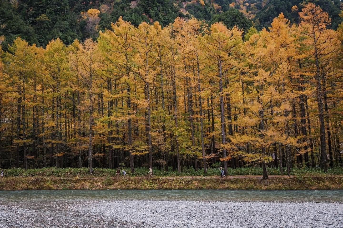
Kamikochi in One Autumn Day: Catch the Early-Morning Mist and Make the Afternoon Bus
20 min · tips
Kamikochi in Fall: Avoiding the Crowds and Calculating the Full Cost for 1–2 Days
17 min · tips
Kamikochi in Autumn: A Golden Valley Along the Azusa River
19 min · tips
Sore Legs in Kamikochi—Which Onsen Should You Choose: Hirayu, Sawando, or Shirahone?
17 min · tips