
Kamikochi Hiking Guide: Valley Trails, Access and Seasons
Kamikochi without a car: how to get in, the flat valley walks from Taisho Pond to Myojin and Tokusawa, when the valley is open, and what to pack.
May 4, 2026·✍️ olablog·⏱ 6 min read
Kamikochi without a car: how to get in, the flat valley walks from Taisho Pond to Myojin and Tokusawa, when the valley is open, and what to pack.
Tap a region to browse articles
Kamikochi is a high mountain valley in Nagano Prefecture, about 1,500 m above sea level, where the clear Azusa River runs beneath the rock walls of the Hotaka range. It is part of Chubu-Sangaku National Park and is the classic gateway to the Northern Alps. What surprises most first-timers is how easy the walking is: the main trails follow the valley floor and are almost flat, so you can see the best of Kamikochi without any climbing experience, while serious mountaineers use the same paths as the first leg of multi-day routes to the peaks.
Why go
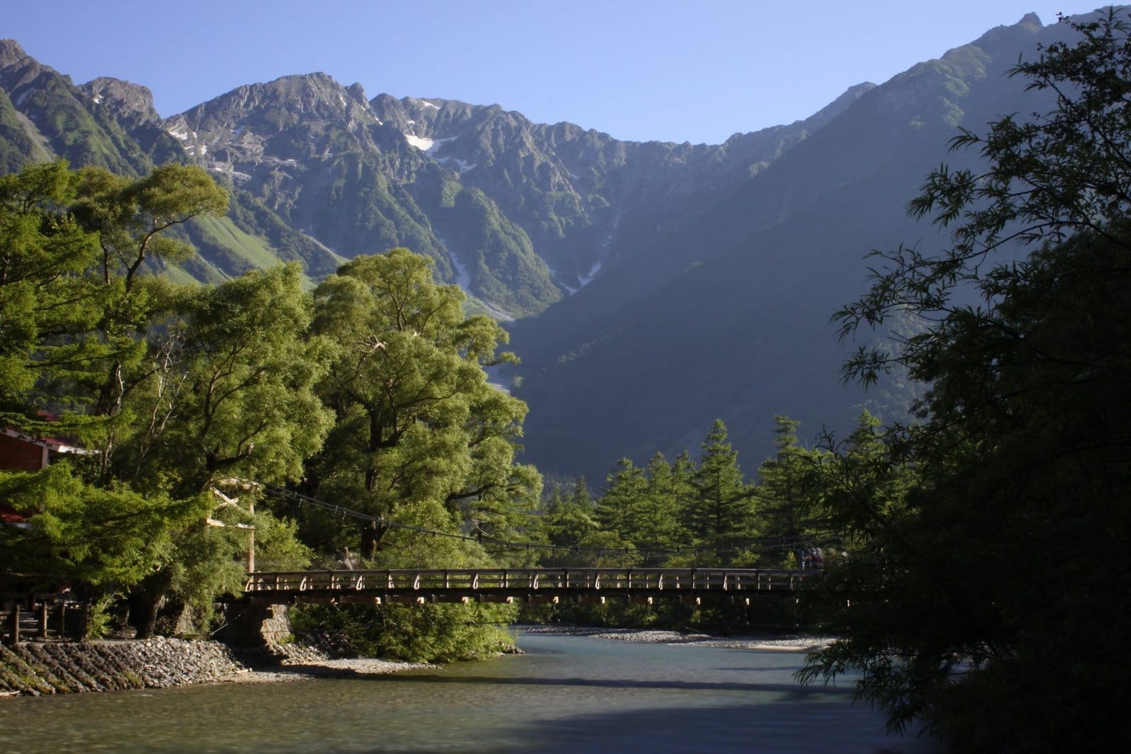
Upstream, the Hotaka peaks rise as a jagged wall, topped by Okuhotaka, at about 3,190 m the highest summit in the Northern Alps. Downstream, Mount Yake, an active volcano, closes the valley. In between are larch forests, marshes, ponds and a river whose colour changes with every bend. Early mornings, when mist lifts off the water, are the best time of all.
Kamikochi also has a place in mountaineering history. The British missionary Walter Weston climbed in these mountains in the late nineteenth century and wrote about them for readers abroad, helping to popularise the name "Japanese Alps". A bronze relief of him is set into a rock by the river, and a festival in his honour is held each June.
Getting in: no private cars
Private cars are banned from the valley road. Drivers park at Sawando on the Nagano side or at Hirayu Onsen on the Gifu side and continue by shuttle bus or taxi. Everyone else arrives by bus.
- From Tokyo: the Azusa limited express from Shinjuku to Matsumoto takes about two and a half hours, then the small Kamikochi Line runs to Shin-Shimashima in about 30 minutes, and the bus into the valley takes a little over an hour. In season there are also direct buses from Shinjuku, including overnight services that arrive at dawn.
- From Takayama: buses run toward Kamikochi via Hirayu Onsen, where you usually change. Allow roughly 1.5 to 2 hours in total, including the change.
- Last buses: the last departures out of the valley leave in the late afternoon. Miss the last one in peak season and you will be scrambling for one of very few rooms.
Most buses stop at Taisho Pond before reaching the main Kamikochi bus terminal, which is a few minutes' walk from Kappa Bridge. Our guide to Kamikochi in one autumn day from Tokyo compares the overnight coach with doing it yourself by train and bus.
The valley walks
Taisho Pond to Kappa Bridge. About an hour of flat walking along the river. Taisho Pond was formed in 1915 when an eruption of Mount Yake dammed the Azusa River; the few dead trees still standing in the water are one of the valley's signature views. The path continues past Tashiro Pond and along boardwalks through marshland, which are especially beautiful when the larches turn gold.
Kappa Bridge. This wooden suspension bridge is the heart of Kamikochi, with the Hotaka peaks upstream and Mount Yake downstream. Hotels, lodges, the visitor centre and the places to eat are clustered nearby.
Kappa Bridge to Myojin Pond. About 3 km and roughly an hour each way, on either bank of the river. Myojin Pond lies in the grounds of the inner shrine of Hotaka Shrine, which charges a small entry fee; on still mornings the pond reflects the forest perfectly. A hut near the pond is known for grilled iwana char. Walk up one bank and back along the other to make a loop.
On to Tokusawa and Yokoo. Another hour or so beyond Myojin brings you to Tokusawa, a broad meadow that was once pasture, with lodges and a campsite. About an hour further is Yokoo, where the valley walk ends and climbers set off for Mount Yari and the Hotaka peaks. Everything beyond Yokoo is genuine alpine terrain that needs experience, equipment and a plan.
When to go
The Kamikochi season runs from around mid-to-late April until mid-November. Outside that window the approach road closes to regular traffic and the hotels and huts shut for the winter.
- Late April to June: snow lingers on the peaks, and the new green of the larches arrives around late May. The rainy season usually follows in June and July.
- Late July to August: one of the busiest times, with alpine flowers, climbers heading for the summits and warm days, though mornings stay cool.
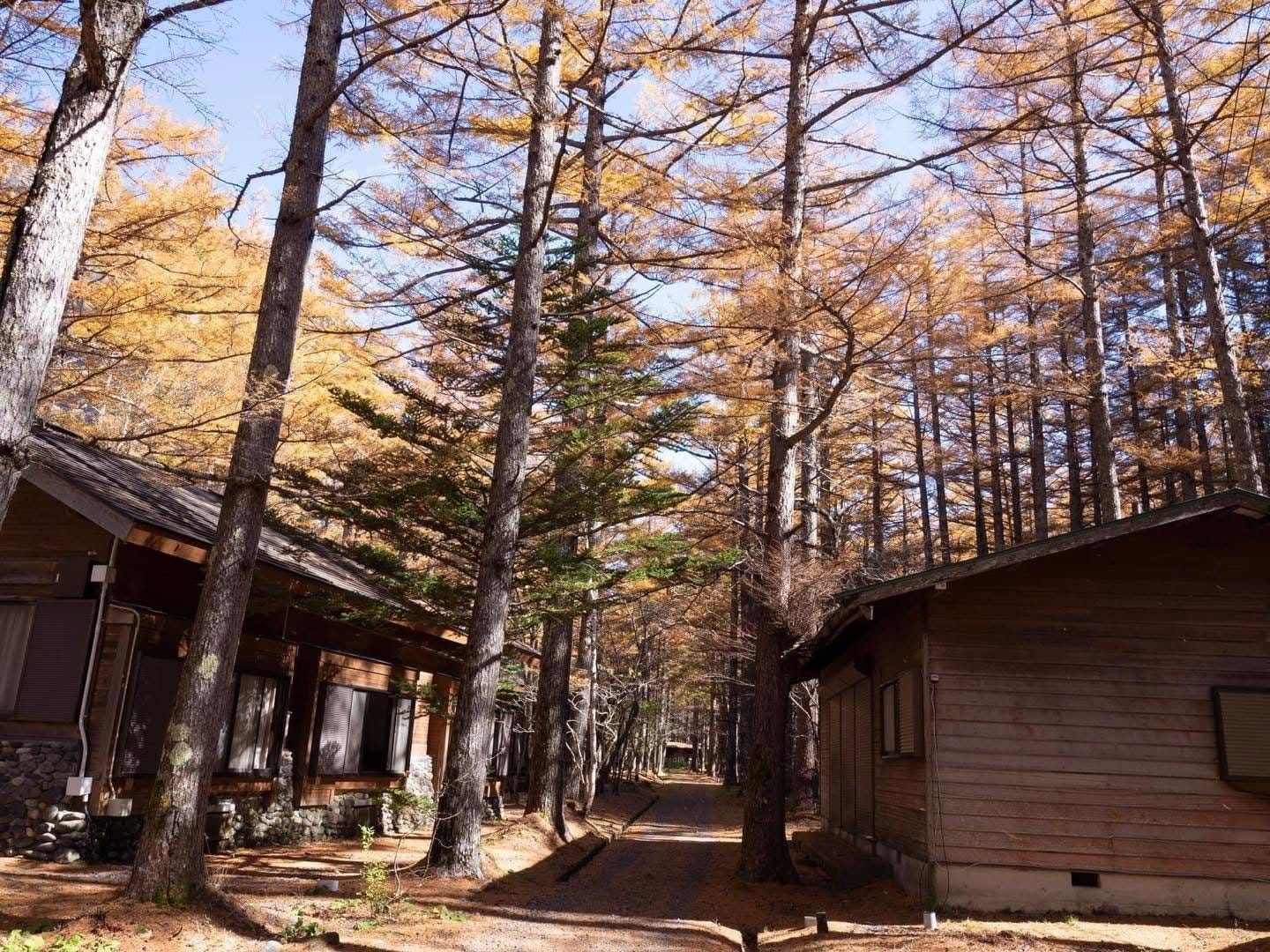
- Autumn: colour starts high on the peaks in late September, and in the valley the larches turn deep gold around mid-October to early November, with the exact timing shifting from year to year.
- Mid-November: the season closes and the valley goes quiet until spring.
Practical tips
- Dress in layers. Mornings can be near freezing in spring and autumn even when midday is warm. Bring a windproof shell and rain gear in every season.
- Wear shoes with grip. The paths are flat but have roots, stones and wet boardwalk sections.
- Respect the wildlife. Asiatic black bears live in the area, so many walkers carry a bear bell. Never feed the monkeys or leave food unattended.
- Follow national park rules. Stay on the marked trails, do not pick plants and carry all of your rubbish out. Many toilets ask for a small coin donation.
- Do not count on mobile signal on the trails. Save maps and bus times before you set out.
- Book beds early. Rooms inside the valley are few and sell out first in summer and the autumn colour weeks.
Plan your trip
For a single day, ride in early, get off at Taisho Pond, walk down to Kappa Bridge and continue to Myojin Pond before heading back for the bus. With a night in the valley, add Tokusawa and enjoy the calm hours at dawn and dusk after the day-trippers leave. Staying in Matsumoto instead also works, but means catching an early bus in. For detailed walking times on the longer trails, see our Kamikochi summer walking trails guide.
More from this region — Chubu (Nagano, Kanazawa)
View all →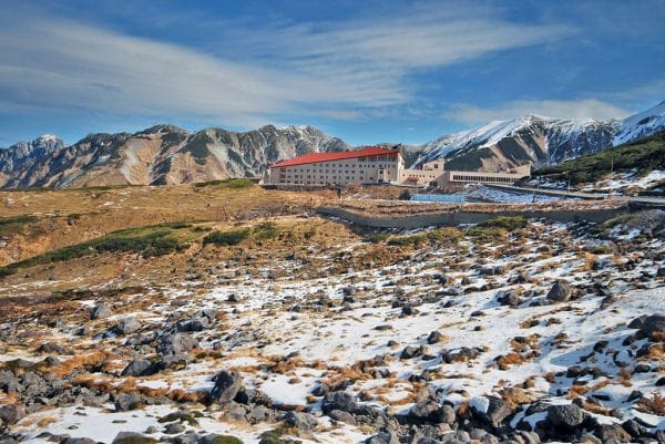
Tateyama Kurobe Alpine Route: Hiking Trails from Murodo
6 min · experiences
Hot-Air Balloon in Japan — 5 Minutes Over the Alps at a Surprising Price
2 min · tips
Outdoor Summer Camps for Kids in Japan — Why Parents Pick Hakuba
2 min · tips
One Night in Kamikochi: Choosing Where to Stay and Planning a Two-Day Autumn Itinerary
16 min · tips