
Amami Oshima Mangrove Kayaking and the Island's Best Beaches
Paddle the Sumiyo mangroves at high tide, swim at Tomori and Ohama, and spot Amami Oshima's rare wildlife: how to get there, when to go, what to book ahead.
May 4, 2026·✍️ olablog·⏱ 5 min read
Paddle the Sumiyo mangroves at high tide, swim at Tomori and Ohama, and spot Amami Oshima's rare wildlife: how to get there, when to go, what to book ahead.
Tap a region to browse articles
Amami Oshima sits in the chain of islands between Kyushu and Okinawa and belongs to Kagoshima Prefecture. Steep forested mountains cover much of the interior, rivers run down to mangrove-lined estuaries, and coral reefs ring long stretches of the coast. In 2021 the island was inscribed as part of a UNESCO World Natural Heritage site, together with Tokunoshima, the northern part of Okinawa Island and Iriomote, for its rare wildlife. A good day here is simple: a morning in a kayak, an afternoon on the sand, and a bowl of keihan chicken rice for dinner.
Getting there and getting around
Amami Airport is at the northern end of the island. There are direct flights from Tokyo and Osaka, with low-cost carriers on some routes, as well as from Fukuoka, Kagoshima (about an hour) and Naha. The slower alternative is the overnight ferry from Kagoshima to Naze, the island's main town, which takes about 11 hours.
Once you land, rent a car. The island is long, the roads wind, and buses are infrequent. The main road runs down the length of the island, from the airport area through Naze and past the mangroves at Sumiyo to Koniya in the south. Traffic drives on the left, and visitors need an International Driving Permit or an approved licence translation. Book early for summer and Japanese holiday periods, when cars run out.
Base yourself near the airport, close to several beaches, or in Naze, which has the most restaurants.
Kayaking the Sumiyo mangroves
The mangrove forest at Sumiyo, in the middle of the island south-east of Naze, grows where the Yakugachi and Sumiyo rivers meet the sea. It is often described as the second-largest mangrove forest in Japan after Iriomote's. The two main trees are the mehirugi and ohirugi mangroves, whose tangled roots stand in the brackish water.
Tide decides everything. Guided canoe and kayak tours run around high tide, when the channels fill and you can paddle deep under the canopy, so start times shift from day to day. At low tide the water drains away and the mud flats are exposed. That is when fiddler crabs and mudskippers come out, easily watched from the banks. Kuroshio no Mori Mangrove Park, beside the forest, rents canoes, runs guided tours and has an observation deck.
The paddling is gentle, on flat water, and most tours welcome beginners and families; check the minimum age when booking. Tours usually last an hour or two. Wear quick-drying clothes and shoes that can get wet, and bring a hat, sunscreen, insect repellent and a waterproof pouch for your phone. Stay in the channels, do not grab or step on the roots, and leave the crabs where you find them.
The best beaches
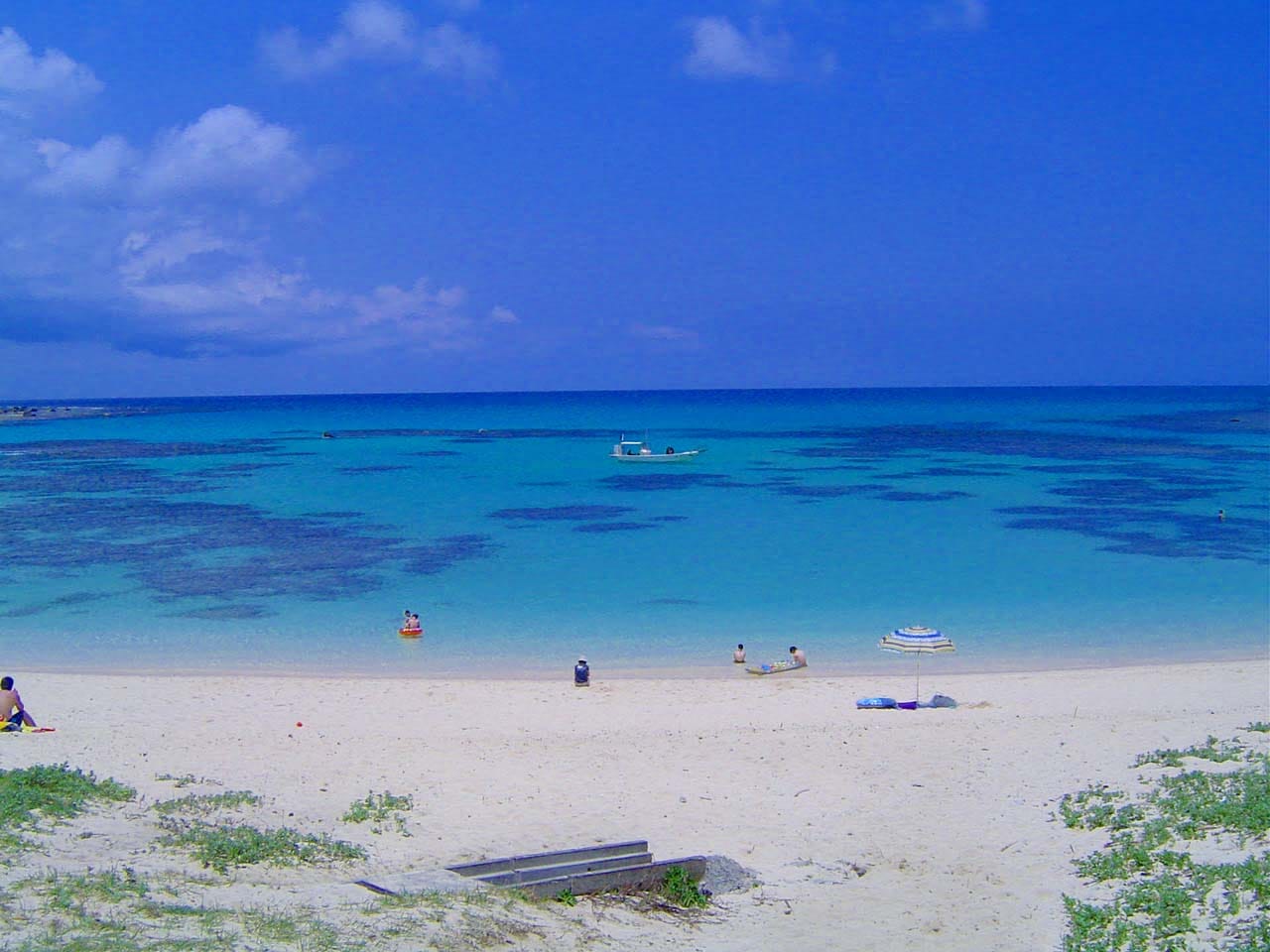
Tomori Beach, a short drive from the airport, is the island's classic postcard view: a white sand beach in front of a shallow, reef-protected lagoon that shades from pale turquoise to deep blue. Being so close to the airport, it makes an easy first or last stop.
Ohama Seaside Park, on the west coast near Naze, is a curving, family-friendly beach known for sunsets over the East China Sea. The Amami Marine Exhibition Hall in the park is a good introduction to the island's sea life.
Ayamaru Cape, on the Kasari Peninsula in the north, is a grassy headland with a wide view over the reef and the Pacific.
Heart Rock in Tatsugo is a heart-shaped tide pool in the rocks that only appears at low tide.
For quieter sand, take the short ferry from Koniya to Kakeroma Island, across the strait from Amami's southern tip.
Snorkelling is best from a sheltered beach or with a local guide. Currents can be strong near the reef edge and in the channels through it.
Wildlife and the forest
The Amami rabbit, a dark, short-eared rabbit found only on Amami Oshima and Tokunoshima, comes out at night, and licensed guides run night tours to look for it along forest roads. The blue-and-chestnut Lidth's jay is found only in the Amami islands and is easier to see by day. The Kinsakubaru primeval forest, full of giant tree ferns, can only be entered with a certified guide.
Two cautions. The island has the habu, a venomous snake, so stay on paths, avoid long grass and do not reach into bushes or stone walls, especially after dark. And drive slowly on mountain roads at night, when rabbits and other animals cross.
When to go
- Late spring and early summer: the rainy season arrives earlier than on the Japanese mainland, often from around mid-May into June.
- July: often the clearest, calmest stretch for beaches and snorkelling, between the rains and the height of the typhoon season.
- August and September: hot, busy and the main typhoon season. Flights and ferries can be cancelled, so keep a spare day at the end of your trip.
- Autumn: pleasant for kayaking and hiking, with fewer visitors.
- Winter: too cool for most swimmers, but humpback whales pass offshore, roughly from January to March.
Practical tips
- Check tide times before booking a kayak tour or visiting Heart Rock.
- Carry some cash for small restaurants and shops outside Naze.
- Try keihan, rice topped with shredded chicken, egg and other toppings with hot chicken broth poured over, and kokuto shochu, a spirit made from brown sugar that is produced only in the Amami Islands.
- Do not take coral, live shells or plants from beaches and forests.
Plan your trip
Allow at least three nights. Spend one day on the northern beaches around the airport, one on the mangroves and the drive south towards Koniya or Kakeroma, and keep an evening free for a night wildlife tour. For more sights, culture and ferry details, see our complete Amami Oshima guide.
More from this region — Okinawa
View all →
Snorkeling Ishigaki: Best Reefs, Seasons and Safety Tips
5 min · experiences
Miyakojima Beaches: Maehama, Sunayama and Reef Snorkeling
5 min · experiences
Ogasawara Islands: The Ferry, Dolphins, Whales and Island Life
6 min · experiences
Chartering a 45-Seat Bus in Okinawa: A Complete Group Travel Guide
8 min · tips