
![The Ultimate Guide to Japan's Best Hidden Scenic Driving Routes [2024 Edition]](/_next/image?url=%2Fimg%2Fwiki%2Fnaruto-whirlpools-jaw-dropping-natural-wonder-2.jpg&w=1200&q=75)
The Ultimate Guide to Japan's Best Hidden Scenic Driving Routes [2024 Edition]
Want to enjoy Japan's spectacular scenery away from the crowds? Discover carefully selected hidden-gem driving routes across the country, from coastal roads and mountain passes to landscapes that change beautifully with the seasons. This detailed guide covers access, costs, highlights, and the best times to visit, making it a useful reference for planning your next road trip in Japan.
Apr 10, 2026·✍️ olablog·⏱ 18 min read
Want to enjoy Japan's spectacular scenery away from the crowds? Discover carefully selected hidden-gem driving routes across the country, from coastal roads and mountain passes to landscapes that change beautifully with the seasons. This detailed guide covers access, costs, highlights, and the best times to visit, making it a useful reference for planning your next road trip in Japan.
Japan is home to countless scenic driving routes that lead to breathtaking landscapes. However, famous destinations featured in guidebooks can become crowded with tourists, making it difficult to slow down and truly enjoy the scenery. This guide focuses on Japan's hidden-gem driving routes—places where you can avoid the crowds while experiencing the country's rich nature and culture at a deeper level—and introduces what makes each one special.
Leaving behind the noise of the cities, you will find magnificent scenery unfolding beyond the car windows, historic streetscapes, and memorable encounters with delicious local food. Together, these experiences can become some of the most lasting memories of your trip. We hope this guide will help you plan your next driving adventure in Japan.
Why Japan's Hidden-Gem Driving Routes Are So Appealing
The appeal of driving in Japan lies in its variety. From the wide-open landscapes of Hokkaido in the north to the beautiful remote islands of Okinawa in the south, every region offers drivers a different kind of scenery. Routes known as “hidden gems” tend to share the following characteristics:
- Untouched nature: Because these places have not been heavily developed for tourism, you can experience nature in a more authentic and unspoiled form.
- Scenery that changes with the seasons: Spring cherry blossoms, fresh summer greenery, autumn foliage, and winter snow create a constantly changing landscape that offers something new even if you return several times.
- Connections with local culture: Visiting small towns and villages can lead to encounters with local traditions, regional culture, and welcoming residents.
- Peace and a sense of freedom: Choose roads with lighter traffic and you can enjoy the scenery at your own pace, without being disturbed, while leaving behind the fatigue of everyday life.
How to Choose a Hidden-Gem Driving Route
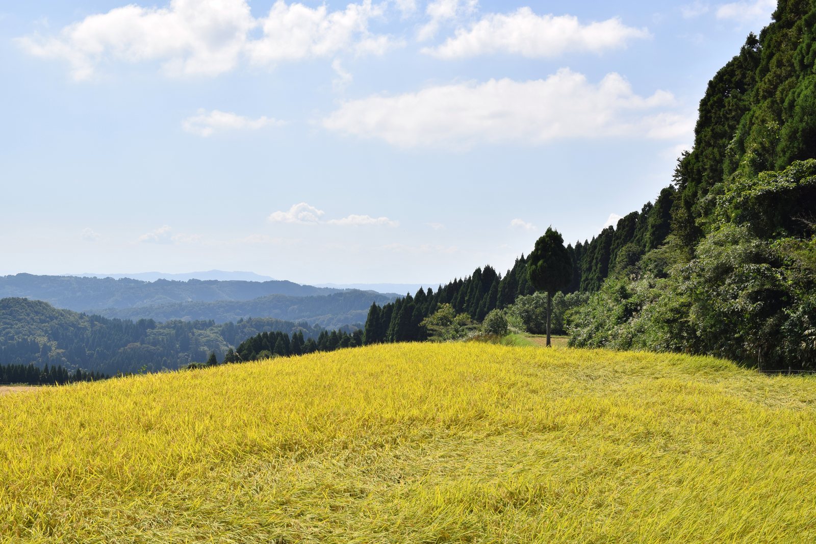
When choosing a hidden-gem driving route, keeping a few key points in mind will help you plan a more rewarding trip.
- Choose a theme: Deciding on a theme such as “coastal scenery,” “mountain roads,” or “a journey through history” makes it easier to select a route.
- Driving distance and time required: Consider a manageable driving distance and leave enough time for sightseeing rather than creating an overly ambitious schedule. Hidden routes may have few gas stations or convenience stores, so checking facilities in advance is especially important.
- Best season: The ideal time for beautiful scenery varies depending on the destination. For example, choose a mountain road in early spring if you want to see snow corridors, or plan around the appropriate season for fresh greenery or autumn foliage.
- Check road conditions: Some routes described as hidden gems have narrow sections or stretches of unpaved road. Check maps and online road information in advance and choose a suitable vehicle. In winter, many sections may close because of snow and ice, so obtaining the latest information is essential.
Ch千里浜なぎさドライブウェイ: A Scenic Drive Along the Noto Peninsula (Ishikawa Prefecture)
Japan's only public beach where ordinary passenger cars can drive, the Ch千里浜なぎさドライブウェイ is a truly remarkable road stretching approximately 8 km from Hakui City to Hodatsushimizu Town in Ishikawa Prefecture. Driving beside the water while feeling the sea breeze is an experience unlike any other. The sand is fine and compacted by seawater, making it possible for cars, buses, motorcycles, and bicycles to travel along the beach. A drive with the ocean breeze washing over you is a wonderful way to forget everyday life. At sunset, in particular, the sun sinking over the Sea of Japan turns the horizon red and creates a wonderfully romantic atmosphere.
- Address: From Ch千里浜北口 in Hakui City, Ishikawa Prefecture, to 今浜口 in Hodatsushimizu Town
- Access: The road begins immediately after exiting the Imahama IC or Chirihama IC on the Noto Satoyama Kaido. It takes approximately 40 minutes by car from central Kanazawa.
- Cost: Free
- Time required: Approximately 15 minutes one way
- Best season: Summer is ideal for swimming and viewing sand sculptures, while the scenery is particularly beautiful around sunset. The road may close during bad weather, so check the Ishikawa Michi Joho Net website in advance.
- Tip: When driving on the beach, avoid dry sand farther from the shoreline as well as muddy areas too close to the sea. It is best to stay on the damp, firmly packed sand. After your drive, you can use the free tire shower at Roadside Station Noto Chirihama.
##霧ヶ峰ビーナスライン: Driving Across the High-Altitude Plateau (Nagano Prefecture)
Located almost in the center of Nagano Prefecture, the Kirigamine Venus Line is a scenic road approximately 76 km long that runs through the Yatsugatake-Chushin Kogen Quasi-National Park. Winding through highland areas above 1,000 m in elevation from Chino City to the Utsukushigahara Highlands, it offers sweeping panoramic views. From the dazzling fresh greenery of late May, through July when Nikko kisuge daylilies are in full bloom, to the beautiful autumn colors of early October, the landscape takes on a different character with every season. Around Kurumayama Highlands and Kirigamine, the contrast between the vast grasslands and open sky is particularly breathtaking. At Yashimagahara Marsh, you can also enjoy walking while observing a wide variety of alpine plants.
- Address: From Kitayama in Chino City, Nagano Prefecture, to Matsumoto City (Utsukushigahara Highlands)
- Access: From the Suwa IC on the Chuo Expressway, take National Route 152 for approximately 5 minutes to reach the starting point at the Gozaishi Shrine intersection.
- Cost: Free
- Time required: Approximately 1 hour 30 minutes from start to finish without detours
- Best season: From mid-June through late July, you can see large fields of azaleas and Nikko kisuge daylilies. For autumn colors, mid-October to early November is recommended. Some sections close during winter, generally from late November to around mid-April.
- Tip: Attractions including Lake Shirakaba, Kurumayama Highlands, and the Kirigamine Nature Conservation Center are scattered along the Venus Line and can easily be combined with the drive. Rest stops include Roadside Station Venus Line Lake Tateshina and Tabi no Eki Kirigamine Venus, where you can eat, buy souvenirs, and refuel.
Aso Panorama Line: Experience the Great Outdoors of Aso (Kumamoto Prefecture)
Running around Mount Aso in Kumamoto Prefecture, the Aso Panorama Line is a driving route where you can experience up close the magnificent scenery created by one of the world's largest calderas. The route passes through some of Aso's most famous scenic locations, including Kusasenrigahama and Komezuka, and the immense scale of the landscape is overwhelming. In the expansive pastureland, you may see relaxed Aso Akaushi cattle grazing, creating a peaceful pastoral scene. In autumn, the silver pampas grass turns golden and gives the landscape an almost dreamlike atmosphere. Because Mount Aso is an active volcano, always check for restrictions around the crater area.
- Address: From Kurokawa in Aso City, Kumamoto Prefecture, to Ichinoseki and Shimono in Minamiaso Village (including the Aso Yoshida Line)
- Access: Approximately 40 to 60 minutes by car from the Kumamoto IC on the Kyushu Expressway
- Cost: Free (however, the Aso Mountain Park Road leading to Nakadake Crater may charge a fee; the fee for an ordinary passenger car is ¥1,000, or approximately $6.70 at ¥150 to the US dollar)
- Time required: Approximately 1 hour 30 minutes to 2 hours for the entire Aso Panorama Line, without detours
- Best season: May to June is beautiful for fresh greenery, July to August for alpine flowers, and October to November for golden pampas grass. In winter, studless winter tires or chains may be required because of icy or snowy roads.
- Tip: Volcanic activity can lead to road restrictions, so check the latest information with the Aso Information Center (0967-34-1600) or Kumamoto Prefecture's road information website before setting out. You can also enjoy horseback riding at Kusasenrigahama.
Tsunoshima Bridge: Where the Sea and Sky Meet (Yamaguchi Prefecture)
Located in Shimonoseki City, Yamaguchi Prefecture, Tsunoshima Bridge is a beautiful 1,780 m bridge stretching in a straight line across emerald-green water. Its scenery has been selected for the book Spectacular Views of the World You Must See Before You Die and it is also well known as a location for commercials and television dramas. In addition to the exhilarating experience of crossing the bridge, observation points at Kaigase Park on the Honshu side and Sezaki Hinode Park on Tsunoshima offer excellent views for photographing the entire bridge against the cobalt-blue sea. On clear days, especially during daylight hours, the scenery resembles a tropical island resort.
- Address: From Kanda in Hohoku Town, Shimonoseki City, Yamaguchi Prefecture, to Tsunoshima
- Access: Approximately 1 hour via National Route 435 from Mine IC on the Chugoku Expressway, or approximately 1 hour 10 minutes via National Route 191 from Shimonoseki IC on the Chugoku Expressway. From Kottoi Station on the JR San-in Main Line, take a bus for approximately 20 minutes, get off at Hotel Nishi-Nagato Resort Iriguchi, and walk 5 minutes.
- Cost: Free
- Time required: Crossing the bridge takes approximately 3 minutes, but allow at least 1 hour if you include photography at the observation points and sightseeing in the surrounding area.
- Best season: Clear weather during the day offers the most beautiful views. The sea is particularly vivid in summer. Seasonal highlights also include rapeseed flowers in spring and daffodils in winter.
- Tip: The bridge may close in strong winds, so check conditions in advance during bad weather. Tsunoshima also has attractions such as Tsunoshima Lighthouse and Shiokaze no Sato Tsunoshima, making them easy additions to your drive.
Shiretoko Pass Road: Through the Primeval Forests of Shiretoko (Hokkaido)
Crossing the Shiretoko Peninsula, a UNESCO World Natural Heritage Site in Hokkaido, Shiretoko Pass Road (National Route 334) is an approximately 28 km driving route that brings you close to Shiretoko's immense natural environment. The road winds along the slopes of Mount Rausu, offering dramatic views of the Shiretoko mountain range and vast landscapes formed by untouched primeval forests. From Shiretoko Pass, the highest point on the road, you can look directly toward the imposing Mount Rausu and, on clear days, see as far as Kunashiri Island. Even in late July, snow can remain along the roadside, while the crisp air conveys the rugged severity of Shiretoko's natural environment.
- Address: From Utoro in Shari Town, Shari District, Hokkaido, to Rausu Town, Menashi District
- Access: Approximately 1 hour 30 minutes by car from JR Shiretoko-Shari Station
- Cost: Free
- Time required: Approximately 40 to 50 minutes one way
- Best season: The road is generally open from early May through early November. Recommended highlights include fresh greenery in June, lingering snow and alpine plants in July, and autumn colors from late September through October.
- Tip: Shiretoko Pass Road closes for winter every year from around early November until late April. Shortly after opening and during bad weather, time restrictions or closures may apply, so check the latest road conditions on the Hokkaido Regional Development Bureau website and other official sources. Shiretoko Pass Observatory offers views of Mount Rausu and Kunashiri Island.
Zao Echo Line: A Route with a Different Face in Every Season (Miyagi and Yamagata Prefectures)
Crossing the Zao mountain range between Miyagi and Yamagata prefectures, the Zao Echo Line is a mountain road approximately 26 km long. Its appeal lies in the spectacular natural scenery that changes throughout the year: a snow corridor in spring, deep green foliage in summer, and autumn colors in fall. The spring snow corridor is a particularly special, limited-season experience, with the road passing between snow walls that can reach 10 m high. From the highest point of the Zao Echo Line, you can take the Zao High Line, a toll road, to view the volcanic crater lake known as Okama. Its emerald-green surface changes color depending on the time of day and the weather, creating a mysterious landscape.
- Address: From Zao Town, Katta District, Miyagi Prefecture, to Kaminoyama City, Yamagata Prefecture
- Access: Approximately 30 minutes from the Shiroishi IC on the Tohoku Expressway via National Route 457 to the Miyagi-side entrance at the large torii gate
- Cost: Free (the Zao High Line leading to Okama is a toll road; ¥550, or approximately $3.70, for a kei or ordinary passenger car)
- Time required: Approximately 50 minutes for the entire Echo Line without detours. Allow around 2 to 3 hours if visiting Okama.
- Best season: The snow corridor can be enjoyed from immediately after the road opens in late April until around mid-May. Fresh greenery is at its best from late May through June, while autumn colors are recommended from late September through late October.
- Tip: The road closes for winter every year from early November through late April. Even after opening, nighttime closures from 5 p.m. until 8 a.m. the following morning may continue through early May. Emergency closures can also occur because of icy roads or snowfall, so check the latest information on Miyagi Zao Tourism Navi or with the Japan Road Traffic Information Center before your visit.
Makino Pic-Land Metasequoia Avenue: A Surreal Road Lined with Metasequoias (Shiga Prefecture)
Located in Makino Town, Takashima City, Shiga Prefecture, Makino Pic-Land Metasequoia Avenue is a magnificent tree-lined road with approximately 500 metasequoias planted along a stretch of about 2.4 km. The avenue is beautiful in every season, from fresh spring greenery and deep summer foliage to autumn colors and winter snow. During the autumn foliage season, the avenue turns a reddish brown and looks almost like a painting, attracting many visitors. On both sides of the avenue is Makino Pic-Land, an agricultural park offering seasonal fruit picking, meals prepared with local ingredients, and cafés. Stopping here during your drive is a great way to enjoy fresh local flavors.
- Address: 835-1 Terakubo, Makino Town, Takashima City, Shiga Prefecture (Makino Pic-Land)
- Access: Approximately 1 hour 30 minutes from Kyoto Higashi IC on the Meishin Expressway via National Route 161 and the Kosei Road. It takes approximately 30 minutes from Kinomoto IC on the Hokuriku Expressway. From JR Makino Station, take the Makino Kogen Line bus and get off directly at Makino Pic-Land (approximately 6 minutes; adults ¥220, or approximately $1.50).
- Cost: Free
- Time required: Driving along the avenue itself takes approximately 5 minutes, but allow 1 to 2 hours if you include walking, photography, and time at Makino Pic-Land.
- Best season: Fresh greenery is at its best from late April through around June, while autumn colors are best from early to late November. Snowy scenery can also be enjoyed from January through February.
- Tip: The avenue has a designated sidewalk, making it well worth parking and exploring on foot. Rental bicycles are also available at JR Makino Station and Makino Pic-Land. To avoid crowds, visiting early on a weekday is recommended.
Preparations and Safety Tips for a Comfortable Drive
Advance preparation and care while driving are essential for enjoying Japan's hidden-gem driving routes safely and comfortably.
1. Vehicle Checks and Preparation
- Fill the tank: Some hidden routes have very few gas stations. Fill the tank before departure.
- Check the tires: Check tire pressure and tread depth, and for peace of mind, learn where the spare tire or puncture repair kit is stored if one is provided.
- ETC card: If you plan to use toll roads, check that the ETC card has not expired and that it is inserted into the vehicle's ETC unit.
- Emergency kit: It is a good idea to carry an emergency warning triangle, tow rope, flashlight, first-aid kit, and other supplies in case of a breakdown or accident.
- Winter preparation: If you will drive on routes where snow or ice is possible, studless winter tires and carrying tire chains are essential.
2. Check Route Information
- Latest road information: Weather and natural disasters can result in road closures or time restrictions. Check the latest information online or through a road-information app before leaving.
- Use map apps: Map apps on smartphones and car navigation systems are extremely useful, but some areas have no mobile signal. Download an app that works offline or carry a paper map as a backup.
- Check parking: Research parking availability, fees, and capacity at sightseeing spots in advance so that you can stop smoothly along the way.
3. Safety While Driving
- Drive carefully: Reduce your speed and drive defensively in preparation for blind curves, steep slopes, and animals suddenly entering the road.
- Take frequent breaks: Long hours behind the wheel cause fatigue and reduce concentration. Stop regularly to rest and refresh.
- Take your garbage with you: Always take your rubbish with you so that the scenery remains clean.
- Respect wildlife: Particularly in mountain areas, deer, bears, monkeys, and other wild animals may run onto the road. Drive carefully, and do not approach animals unnecessarily if you see them.
The following table summarizes useful information for a driving trip.
| Item | Details |
|---|---|
| Driving license | Carry it with you at all times and check its expiry date. Travelers from overseas need an International Driving Permit or must convert their license to a Japanese license. Requirements vary by country or region, so confirm the rules that apply to your license before traveling. |
| Insurance | Voluntary insurance is recommended. When renting a car, check the details of vehicle, personal injury, and property damage coverage. |
| ETC card | Allows you to pass through expressway toll gates smoothly. Some rental-car companies may offer ETC cards for rent. |
| Rest facilities | Expressways have service areas (SA) and parking areas (PA) where you can eat, rest, and refuel. Ordinary roads also have roadside stations, which are useful for buying local specialties and gathering travel information. |
| Clothing | Choose clothing that makes it easy to adjust your body temperature according to the season and the elevation of your destination. Mountain areas can feel chilly even in summer. |
| What to bring | Smartphone, charger, portable battery, cash (some rural places do not accept credit cards), regular medication, motion-sickness medicine, sunscreen, hat, sunglasses, rain gear, snacks, drinks, and more. |
| Photography | Looking away from the road while driving is extremely dangerous. At scenic spots, pull over in a safe place and take photographs without obstructing surrounding traffic. If you use a drone, comply with local regulations and applicable laws. |
| Accommodation | Booking early is recommended, especially during the sightseeing seasons. Sleeping in your car at a roadside station or service area may be prohibited except for rest purposes, so follow the local rules. |
| Emergency contacts | Keep the police (110), fire and ambulance services (119), and JAF (Japan Automobile Federation, #8139) numbers available in case of an emergency. |
For visitors arriving from overseas, remember that Japan drives on the left, so allow time to get used to the road layout before tackling a remote mountain route. A JR Pass can be useful for reaching a region by train, but it does not cover rental cars, fuel, or road tolls. IC cards such as Suica are convenient for trains and buses, but you should still carry cash for rural areas and driving-related expenses.
Your Own Japanese Journey by Rental Car
The best way to enjoy Japan's hidden-gem driving routes is often by rental car. You can visit places that are difficult to reach by public transportation and stop wherever you like, traveling at your own pace.
✨ Book a rental car with OlaChill and start planning your own special driving trip through Japan.
When renting a car, keep the following points in mind.
- Choosing a vehicle: Select a vehicle suited to the road conditions, number of passengers, and amount of luggage on your route. If you will be driving on snowy roads, a four-wheel-drive vehicle offers added reassurance.
- Reservations: Rental cars can be difficult to secure during major travel periods such as Golden Week, summer vacation, and the autumn foliage season. Booking early is strongly recommended.
- Insurance: Carefully review the insurance offered by the rental-car company and consider adding extra coverage if necessary.
- Car navigation: Check whether the vehicle has an up-to-date navigation system. Multilingual systems are available, so request one in advance if needed.
Japan's beautiful nature, historic landscapes, and warm encounters with local people are sure to make your trip even more rewarding. Use the hidden-gem driving routes introduced in this guide as inspiration, and enjoy a memorable road trip through Japan.
More from this region — Other
View all →
14-Day Japan Itinerary for First-Time Americans
9 min · itineraries
Japan's Best Cherry Blossom Spots: Peak Times, Fees and Access
17 min · seasonal
Don Quijote Shopping Guide: 20 Japanese Souvenirs Worth Buying
16 min · 節約
7-Day Cherry Blossom Japan Itinerary — Peak Sakura Route + Exact Dates
10 min · itineraries